It is widely understood that to engage in the practice of land surveying in North Carolina, one must have an appropriate license.
Less widely understood is what really constitutes the "practice of land surveying." The ever-growing availability of survey-related technology, like drones and mapping programs, has further complicated this issue. However, a recent decision by the United States Court of Appeals for the Fourth Circuit drew a distinct boundary line.
The North Carolina Engineering and Land Surveying Act: An Overview
The North Carolina Engineering and Land Surveying Act (the "Act") regulates engineering and land surveying in the State of North Carolina. The Act prevents any person from practicing or offering to practice land surveying in North Carolina without first being duly licensed by the North Carolina State Board of Examiners for Engineers and Surveyors (the "Board"). The Act defines the "practice of land surveying" to include, among other things:
Providing professional services such as consultation, investigation, testimony, evaluation, planning, mapping, assembling, and interpreting reliable scientific measurements and information relative to the location, size, shape, or physical features of the earth, improvements on the earth, the space above the earth, or any part of the earth, whether the gathering of information for the providing of these services is accomplished by conventional ground measurements, by aerial photography, by global positioning via satellites, or by a combination of any of these methods, and the utilization and development of these facts and interpretations into an orderly survey map, plan, report, description, or project. . . .
Aerial Photography and Land Surveying: Where Is the Line?
So, the Act prohibits certain services "by aerial photography," but what does that really mean? Enter Michael Jones.
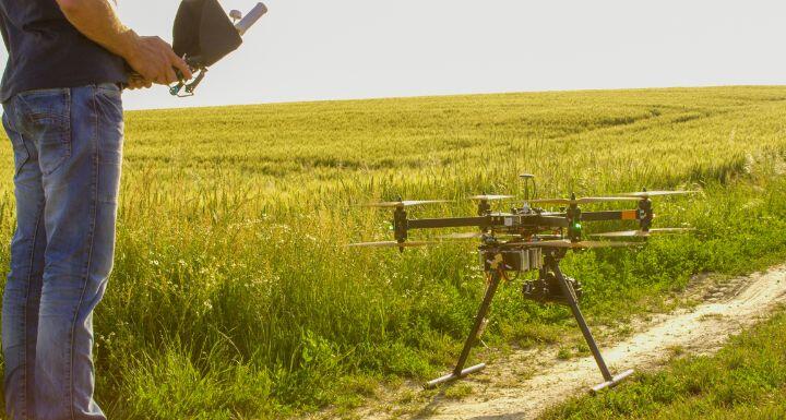
Michael Jones operated a drone photography company that offered aerial mapping services. The company's website advertised that it could create orthomosaic maps that could be used by construction companies to monitor elevation changes, calculate volumetrics for gravel/dirt/rock, and watch the progression of the site as it forms over time. Neither Mr. Jones nor his company were licensed to practice land surveying in North Carolina.
Violating the Act: Professional Conduct vs. Free Speech
The Board notified Mr. Jones that his company's offerings constituted the practice of land surveying and that engaging in those services without a license violated the Act. In response, Mr. Jones and his company filed a lawsuit against the Board's members, arguing that his capturing of images and dissemination of the same was a form of speech and that the Board's prohibition violated his First Amendment right to free speech. The Court disagreed.
The Court recognized that the use of drones to capture images for the purpose of conveying measurable data is a form of professional conduct that incidentally burdens speech, the regulation of which implicates the First Amendment. However, the fact that regulation of speech implicates the First Amendment does not mean that the regulation violates the First Amendment. Instead, the Court recognized that the state may regulate this kind of professional speech so long as the state has a "substantial interest" in regulating the activity or speech and the solution is "sufficiently drawn" to protect that interest.
The State’s Substantial Interest in Regulating Surveying
The Court first considered whether North Carolina has a "substantial interest" in regulating the unauthorized practice of land surveying and held that it does. As stated in the Act, the Board's purpose for regulating surveying is "to safeguard life, health, and property, and to promote the public welfare." The Act establishes a minimum level of competence that aims to protect the public from negligence, incompetence, and professional misconduct. The state, the Court determined, has a substantial interest in upholding that standard to protect the public.
How the Act Protects the Public: Competence and Safety
Next, the Court held that the Act is "sufficiently drawn" to protecting that substantial interest. The Act, as applied by the Board, does not prevent all drone activity that involves capturing photos or videos. The court specifically noted that unlicensed individuals are still permitted to convey aerial photos and may even draw rough property lines in some circumstances. Instead, the Act just restricts unlicensed individuals from creating maps or models conveying location information or property images capable of measurement. The court held that this prohibition reasonably fit the state's substantial interest in protecting the public.
What Does This Mean for Drone Photographers?
This case may not be over, though. Mr. Jones has filed a petition for certiorari with the Supreme Court of the United States, asking SCOTUS to review the Court's decision. SCOTUS has not determined yet whether it will accept Mr. Jones's petition and hear this case. For the time being, all unlicensed individuals or entities that provide photography, videography, or mapping services to those in the construction or engineering profession would be well-advised to evaluate whether their activities might violate the Act.
